Heavy Rain and Cold Snap Disrupt Celebrations Across Spain
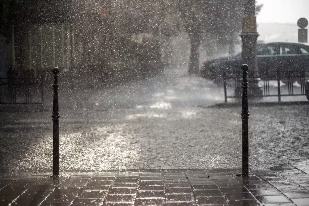
After a period of stable weather, Spain is now experiencing a shift as heavy rain and colder temperatures take hold. An isolated cold front over the Gulf of Cádiz has triggered intense thunderstorms, particularly in southern Andalucía and Ceuta. Flooding has already hit several areas, especially Málaga and inland Cádiz, where persistent downpours have caused significant flooding.
This extreme weather has disrupted celebrations for the Day of Andalucía, which is traditionally marked with parades and outdoor festivities. Many events have been canceled or postponed due to hazardous conditions. The storm is expected to intensify, bringing heavy rain to the southeast, including Murcia and Alicante, over the weekend.
Una vez más baja por mi calle el agua como si de un río se tratara “ así a caído hoy la lluvia en Alhaurín el Grande “ pic.twitter.com/JLv0i5T5nF
— isa azahares (@isaazahares) February 28, 2025
Carnival Parades Affected by Storms
The timing of this storm has been especially unfortunate for Carnival celebrations. Many parades and outdoor activities scheduled for the weekend have been called off or postponed due to the risk of heavy rain and flooding. Authorities have urged everyone to stay informed about weather warnings, as conditions remain unstable.
Where Will the Rainfall Be Most Intense?
According to Spain’s weather agency, AEMET, the heaviest rainfall will hit Málaga, Cádiz, Murcia, Alicante, and Melilla. The Pitiusas Islands (Ibiza and Formentera) are also expected to see significant rain. The downpours could lead to flash flooding, particularly in coastal areas.
Snow Expected as Cold Air Moves In
A polar air mass sweeping across Spain is bringing a sharp drop in temperatures, lowering snow levels. By Sunday, snow could fall as low as 700–800 meters in the northern half of the country, affecting mountain ranges such as the Iberian and Central Systems, the Cantabrian Cordillera, and the Pyrenees. Some parts of the northern plateau may also see snowfall, which could impact travel conditions.
⚠️ Chubascos generalizados en la Península.
— AEMET (@AEMET_Esp) February 28, 2025
⛈️ Los más intensos hoy, en el sur de Andalucía. El sábado se darán sobre todo en el sureste, Baleares y Melilla.
❄️ El domingo los chubascos se generalizarán y nevará en cotas bajas.
Nota informativa 👉https://t.co/2nWLjqLVKd pic.twitter.com/GwYO9wkEtI
More Rain Expected Next Week
Unstable weather is expected to continue into next week, though snow levels will rise, reducing the risk of widespread snowfall. However, rain will persist, particularly along the Mediterranean coast, with a high chance of heavy showers in Valencia and Málaga. Showers may also spread into Cataluña and western Andalucía.
Rainy Conditions in the Canary Islands
The Canary Islands will also see increased rainfall, with heavy showers expected in the interior areas of the larger islands. A weather system moving north of the archipelago could bring stormy conditions on Monday, though rainfall intensity may decrease later in the week.
Travel Warnings and Safety Advice
With severe weather affecting much of Spain, AEMET advises travelers to check road conditions before heading out. Flooding, snow, and strong winds could make travel dangerous. Residents are encouraged to stay updated through official weather reports and take precautions as the storm continues.
Share this content:


2 comments